Leaaving Þórshöfn, I was hoping to reach the tip of Langanes, a remote lighthouse on the north eastern tip of Iceland. There's 50k or so of unmaintained dirt road between here and there though, and the weather, although clear at the moment, had been wet for days, and wasn't exactly promising beach weather. I passed the airport on the left, and onto the dirt.
I stopped briefly at an old church and residence, part way through restoration. Apparently it's a coffee shop in summer. So much for my summer holiday.
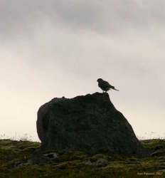
Driving out, I was pleased to see that someone, I suspect the same group that made the netting road near Hraunhafnartangi, had put up nice little informational signs at each of the old farm sites along the peninsula. As on Melrakkasletta, I saw a few merlins, none of them seemed big enough to call falcons, though I thought that at the time.
The remoteness does nothing but grow as you drive out. The shacks get smaller, the state of repair worse, and the road rockier, with bigger puddles.
Well, not entirely. I did pass one or two fairly new summer houses further out, but even they looked like they saw little use. A few ship, and not even many of them. Lots of puddles. Lots of mud.
Eventually I reached Skoruvík. Where there's a "campground" and "water". Or so they claim :) There's ruins from maybe 8-10 buildings, mostly all small, and a short stretch of yellow sandy beach. Plenty of flotsam and jetsam too, and I checked out all the trawl floats looking for one as cool as I found on Hornstrandir. I never found one quite so clear, but I've got one from a similar vintage, that I'll try and clean up at some stage. This is also the point where the road forks into two worse tracks. I was still 10k or so from the lighthouse at Fontur. The road would have taken me a bit further, but it was getting muddier.
I thought about what I really wanted to be doing out here, and thought about how lonely I was, and how much the weather had sucked, and how much I really needed to put up, and how much nicer it would be to come out here with someone to share it with. I'd planned on going as far as the road would take me, and then hiking out and camping overnight at the lighthouse. I decided that there was really no need for that. Instead I would explore the shore around here, see the sights, and then drive back out the road before it rained again, leaving me out at the end of 40k of muddy dirt roads.
Besides, I'd had enough of being by myself like this. Touring the US, I did it for about four months, but it was four months when there was no-one to go back to, and I was driving longer distances between radically different sights. Driving every side road in iceland, seeing similar, yet subtley different sites, in generally miserable weather, when I had a home and friends and, at the time, someone in particular, I cut it and headed for home.
Driving back was much faster, I knew the car could handle everything. I continued south, not stopping for much of anything aside from a roadside pic or two. Vopnafjörður looked bigger than I expected, and had heaps of people milling about downtown. I burnt on, though the road east of Vopnafjörður was spectacular. The road up and over and down Hellisheiði is superb. Steep, windy, colourful and rugged. Cresting the top, with the view over Héraðssandur to Dyrfjöll is truly superb. A drive worth doing, just for the drive.
I pushed all the way to Egilsstaðir for dinner, but I couldn't go home just yet. One of the destinations for this entire trip had been to visit Seyðisfjörður, to try the El Grillo beer there. It was Saturday night, and I asked about the bars in town, but after not hearing much, I decided to head over to Seyðisfjörður, and skip Egilstaðir all together. I don't care if it's always sunny, it really is a quite boring town. I'll talk about Seyðisfjörður tomorrow, with the pictures of Seyðisfjörður.
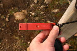
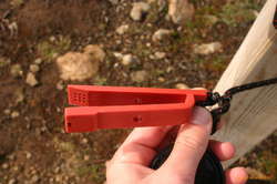
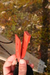
And so ends the story, but there's still some explanation required for a picture or two. The red silva thing attached to the signpost I am clueless to describe. There was nothing in the area that seemed to be used for or with the thing.
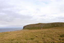
The cutouts at the edge of the cliff were interesting. At least three of the old ruins had them, and I found another one by itself, where presumably there used to be a ruin. These were houses built on the very edge of the cliff, where the floor had a 1m long, by 40cm wide and 40cm deep notch cut into the cliff edge. Very square, some lined with grass, some with wood holding the shape, but consistent in size and location. The cliff edge didn't seem _that_ stable, so although I had thought of a toilet, it seemed there would be better toilet options than straight onto the beach below, probably smearing the cliff on the way, and having to wait for high tide to clean up. I thought possibly for loading something up or down to the shore, but I still couldn't come up with a reason for there to be a notch in the ground. *shrugs*
Update The "strange device" with the Silva markings is an orienteering punch. Each control point would have a different arrangement of needles in the punch.